0

0


Account
- Share -


* Wadi means “valley” in Arabic.
It refers to a dry river bed, except after sudden floods or rains, which happen from time to time in the deserts of Arabia.

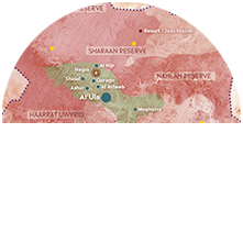
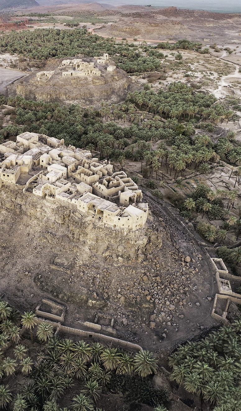
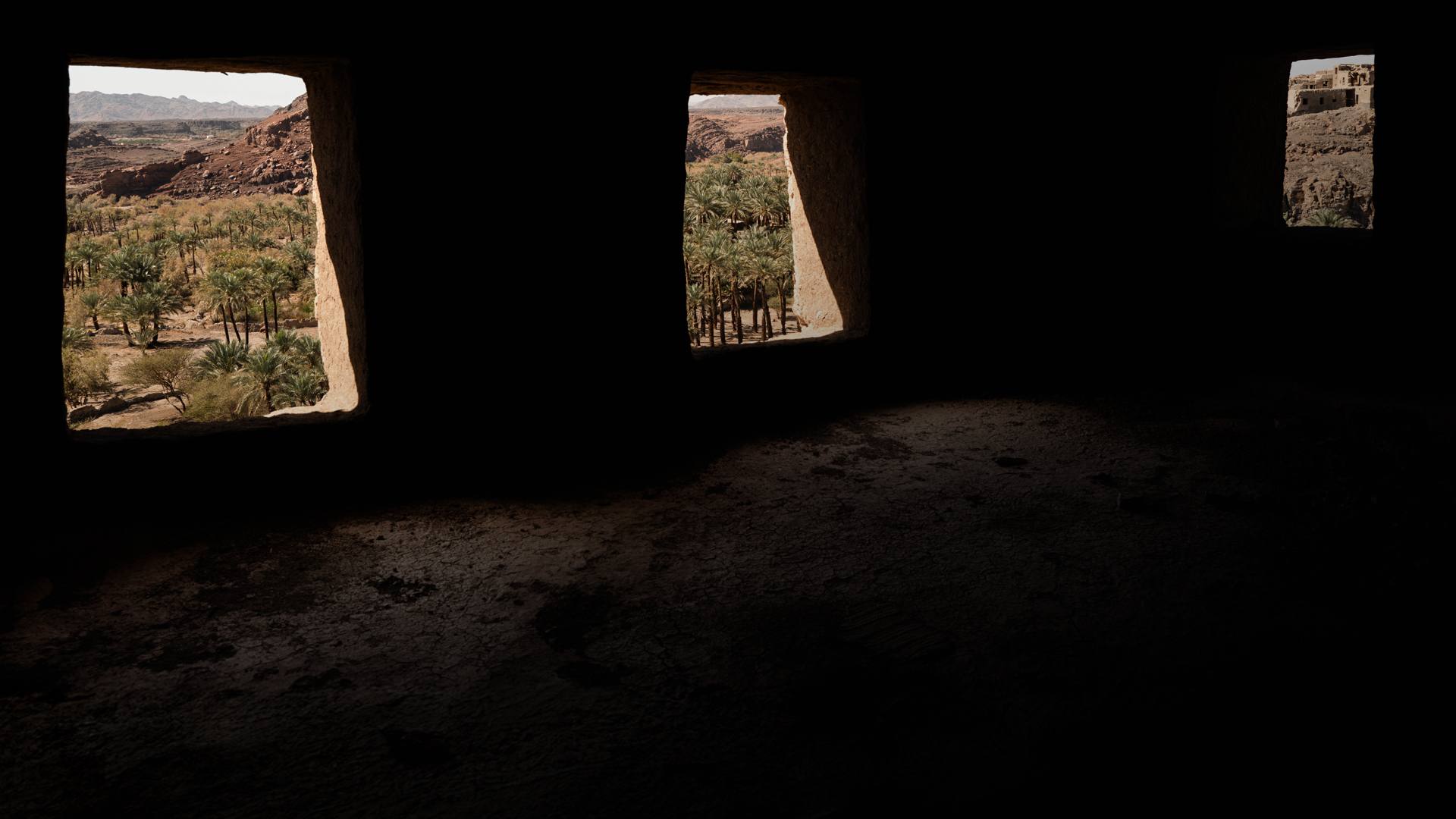
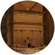
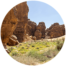
Khaybar is a vast oasis located halfway between Medina and AlUla, close to a volcanic area, which explains its basaltic landscape, which seems quite austere at first glance. The palm grove, luxuriant but in poor condition today, grows mainly in the wadis* that cut through the plateaus. The general impression when walking there is that time has stopped, with its abandoned villages, thousands of timeless megalithic remains, and the fact that the site is still rarely visited today. Urban planning and development has also not yet had a significant impact.
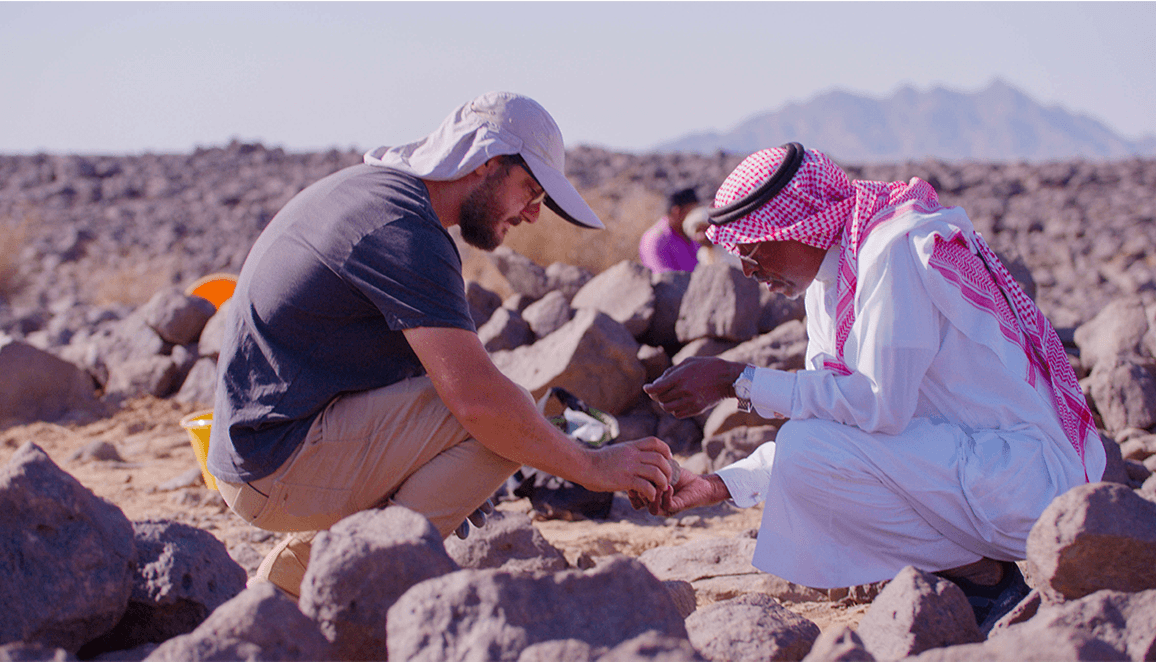
Due to its isolation but also its complicated history linked to the first conquest of the Prophet, the oasis had never been explored in detail before our arrival, and it goes without saying that we were incredibly lucky because the density of archaeological structures from all periods is impressive. The very nature of our research program, which aims to map and date archaeological remains, has led to some very promising discoveries. Without revealing all our results, we can mention our studies of the vast hunting traps (desert kites) and the neighboring Prehistoric camps. In addition, we can include the sequencing of the development of the funerary landscape of the oasis and the discovery of a town connected to an enormous rampart more than 20 km in length from protohistory. We have also carried out an initial survey in the mosque of the Prophet, and uncovered nearly 10,000 years of local paleoclimatic history from well-preserved alluvial archives. All of this will give rise to a multitude of publications in the years to come.


YOU HAVE BEEN WORKING ON THE KHAYBAR SITE SINCE 2020.
WHAT ARE ITS SPECIFIC CHARACTERISTICS AND YOUR MOST RECENT DISCOVERIES?
YOU HAVE BEEN WORKING ON THE KHAYBAR SITE SINCE 2020.
WHAT ARE ITS SPECIFIC CHARACTERISTICS
AND YOUR MOST RECENT DISCOVERIES?

AFALULA has been our main partner with the Saudi authorities since the launch, in 2020, of our archaeological research program, led by the Agency on behalf of the RCU. It was the team from the Archaeology division, led by Dr Ingrid Périssé, who initiated and supported our field project in Khaybar (co-led by Dr Rémy Crassard [CNRS Archéorient] and Dr Munirah al-Mushawh [RCU]). In this aspect, the division team has always provided us with unwavering material and moral support. This support goes well beyond the substantial funding granted to our project by the Agency, which enabled the recruitment of dozens of researchers. It is important to emphasize that AFALULA played a crucial role in establishing contracts, especially concerning logistical and legal aspects, with local authorities and the CNRS. This help also extended to respect for copyright and the interpretation of archaeological data. AFALULA also supports our initiatives to help promote and disseminate results. This support is essential, because researchers are rarely trained in these domains, which are particularly delicate when working in an oasis like Khaybar, whose history is complex and highly sensitive.


HOW DOES THE COLLABORATION WITH AFALULA WORK GIVEN THE CONTEXT OF THE PROJECTS YOU ARE CARRYING OUT IN ALULA?
HOW DOES THE COLLABORATION WITH AFALULA WORK GIVEN THE CONTEXT OF THE PROJECTS YOU ARE
CARRYING OUT IN ALULA?
It is important to remember that Arabia's heritage has received relatively little attention in the media, despite the incredible treasures that the Peninsula contains. Apart from "Happy" Arabia (Yemen) but also Oman and the Emirates, little was known about Arabia even up until a few years ago. However, this situation is beginning to change thanks to the collaborations initiated in the early 2000s with the Saudi Heritage Department (now the Heritage Commission) and the numerous discoveries made in the northwest of Arabia over the past decade, notably with the Royal Commission for AlUla. But a decade of research is nothing compared to the work carried out over the past two centuries in neighboring countries (Jordan, Iraq, Egypt), which also explains the current proliferation of publications highlighting the sensational discoveries from Saudi Arabia that are changing the way we think about the past of the entire region.
Saudi Arabia's heritage is rich and diverse, but often difficult to access. It includes monumental megalithic remains, better appreciated from the sky than on the ground, as well as abundant rock art, often hidden in the vastness of the desert. Among the most famous rock-carvings are to be found in Hegra, Hima, Jubbah and Shuwaymis, all of which are UNESCO World Heritage sites. Newer locations are often isolated and poorly equipped for tourists, with just a few exceptions, most notably in the AlUla valley. We are just at the beginning of the journey, with our efforts primarily going into the creation of an initial inventory of the heritage of the region rather than being at the phase of understanding and contextualizing those archaeological discoveries. However, Saudi Arabia is quickly catching up.


HOW IS THE HERITAGE OF ARABIA, AND MORE PARTICULARLY THE NORTH-WEST WHERE YOU WORK, EXCEPTIONAL?
HOW IS THE HERITAGE OF ARABIA,
AND MORE PARTICULARLY
THE NORTH-WEST
WHERE YOU WORK, EXCEPTIONAL?

* A qanat is a hydro-engineering structure that draws on underground aquifers, transporting water to external points of access. Its opening to the drain is fitted out using mud bricks.
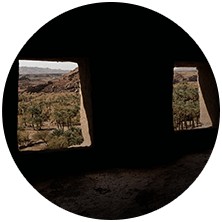
The UCOP project aims to better understand the evolution of the oasis gardens of the AlUla valley and its habitats through an interdisciplinary approach. The pedestrian and aerial survey made the recording and mapping of all the anthropogenic structures— farms, separation walls, irrigation networks, and qanat* openings, etc.—possible. Thanks to the integration of thousands of pieces of data in a geographic information system (GIS), combined with targeted archaeological excavations and the study of the material discovered, it was possible to reconstruct the historical development of these gardens, thus analyzing the evolution of the habitats associated with them and enabling the better understanding of their functioning over the centuries.
This work revealed new dynamics of occupation and use, offering a more precise vision of how resources were managed across this region during the Islamic period. As an example, at the beginning of the 20th century, the AlUla palm grove was a very lively space, occupied for a large part of the year by the inhabitants of the Old Town who came to find refuge there during the warmer months. Finally, these results were integrated into the strategic master plans for the valley, contributing not only to the preservation, but also to the integration and enhancement of this exceptional heritage.
The UCOP project aims to better understand the evolution of the oasis gardens of the AlUla valley and its habitats through an interdisciplinary approach. The pedestrian and aerial survey made the recording and mapping of all the anthropogenic structures— farms, separation walls, irrigation networks, and qanat* openings, etc.—possible.
Thanks to the integration of thousands of pieces of data in a geographic information system (GIS), combined with targeted archaeological excavations and the study of the material discovered, it was possible to reconstruct the historical development of these gardens, thus analyzing the evolution of the habitats associated with them and enabling the better understanding of their functioning over the centuries.
This work revealed new dynamics of occupation and use, offering a more precise vision of how resources were managed across this region during the Islamic period. As an example, at the beginning of the 20th century, the AlUla palm grove was a very lively space, occupied for a large part of the year by the inhabitants of the Old Town who came to find refuge there during the warmer months. Finally, these results were integrated into the strategic master plans for the valley, contributing not only to the preservation, but also to the integration and enhancement of this exceptional heritage.


CAN YOU TELL US ABOUT
THE ARCHAEOLOGICAL MAP
OF THE OASIS WITHIN
THE FRAMEWORK OF THE UCOP PROJECT?
CAN YOU TELL US ABOUT
THE ARCHAEOLOGICAL MAP
OF THE OASIS WITHIN
THE FRAMEWORK OF THE UCOP PROJECT?


Doctor of Archaeology,
co-director of the Khaybar
Longue Durée Project
for the CNRS

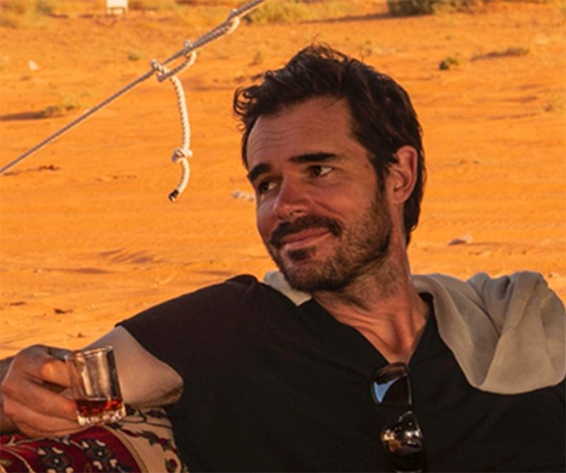
Dr GUILLAUME CHARLOUX
THREE QUESTIONS FOR
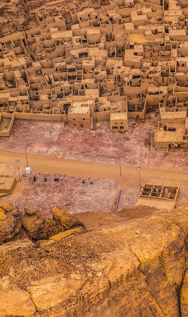
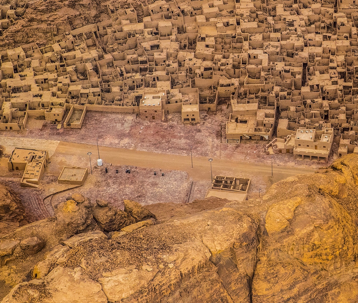
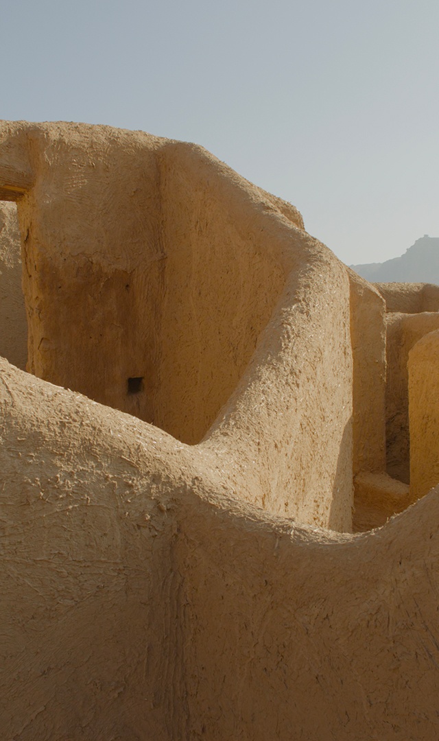
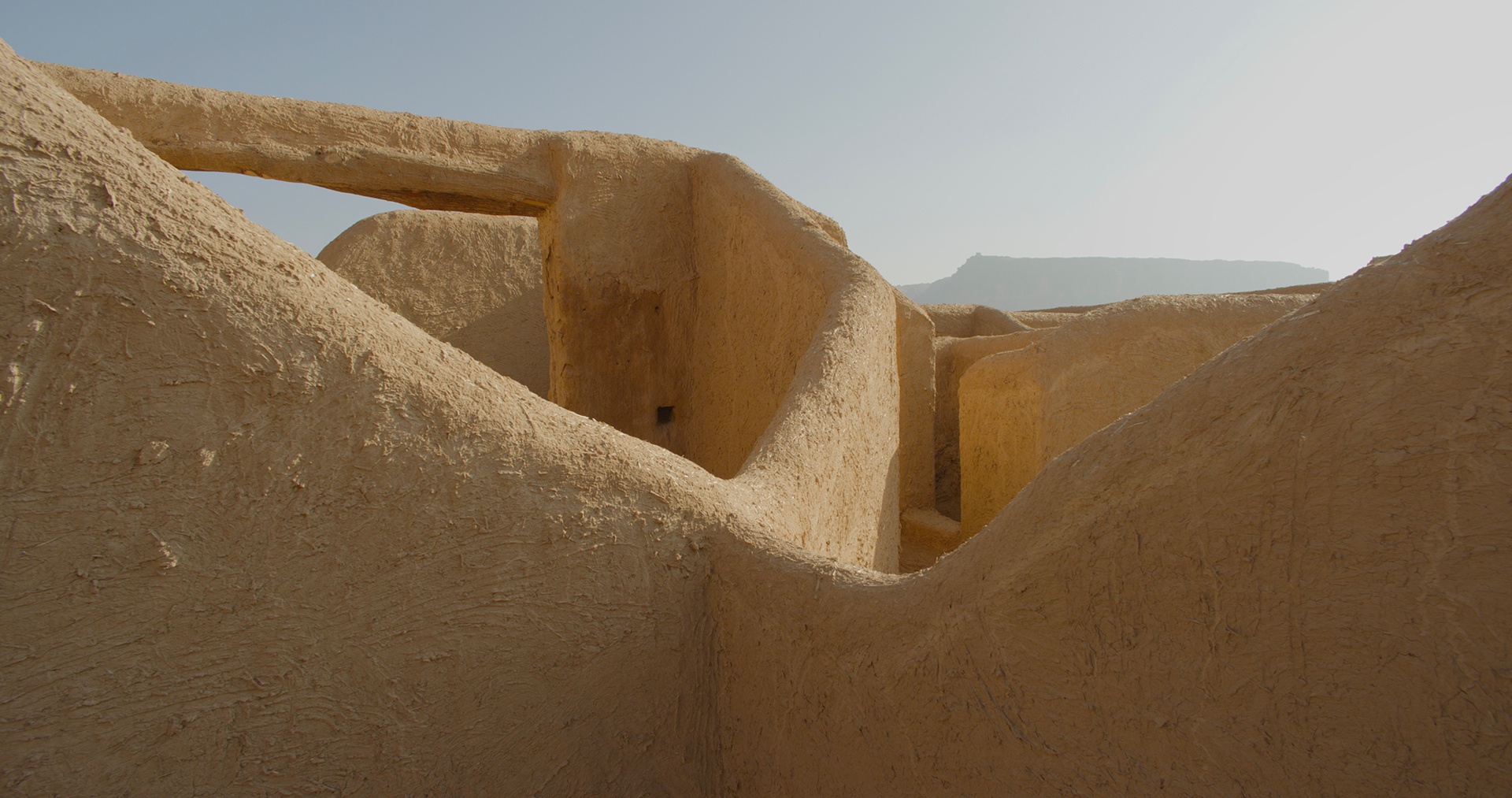
The MUDUD project, dedicated to the study of AlUla’s Old Town, is a one-of-a-kind initiative. Never before has a recently abandoned Islamic town been the subject of such in-depth analysis, combining excavations, building archaeology, architecture, geomatics and geography. Having undergone gradual depopulation since the 1980s, the town had 900 derelict housing units about which almost nothing was known. Their study proved to be a rich source of information on the town's evolution over time, the lives of its inhabitants, its organization and its connection to the palm grove.
Thanks to Archaïos’ interdisciplinary research, its history has been reconstructed, revealing the first traces of occupation from the 3rd-2nd millennium BC, as well as a more precise urban evolution between the 12th and 20th centuries, marked by alternating phases of contraction and expansion. At the same time, this work made it possible to save valuable data before restoration and ensure the successful transmission of its history for future study. Innovative in every way, the project thus contributes to the rebirth of AlUla, bridging the memory of its past and construction of its future.


ONE SPECIFIC POINT OF INTEREST
OF THE OLD TOWN IS THAT IT IS VERY MUCH BLESSED WITH A “LIVING” HERITAGE.
WHAT ASPECTS MAKE THIS PROJECT A UNIQUE ONE?
ONE SPECIFIC POINT OF INTEREST OF THE OLD TOWN IS THAT IT IS VERY MUCH BLESSED WITH A “LIVING” HERITAGE.
WHAT ASPECTS MAKE THIS PROJECT A UNIQUE ONE?
This dynamic has made it possible to build and collaborate across three major projects: UCOP, dedicated to AlUla’s historic gardens, MUDUD, dedicated to the Old Town, and UDAP, centered on an ancient sacred site. In addition to its support for research, AFALULA, in close collaboration with the RCU, is ensuring the effective preservation of heritage, the preservation of the intellectual property of the teams and it continues to support them with the daily challenges encountered in the field. Its commitment helps to preserve and enhance this unique valley, while highlighting French expertise.
This dynamic has made it possible to build and collaborate across three major projects: UCOP, dedicated to AlUla’s historic gardens, MUDUD, dedicated to the Old Town, and UDAP, centered on an ancient sacred site. In addition to its support for research, AFALULA, in close collaboration with the RCU, is ensuring the effective preservation of heritage, the preservation of the intellectual property of the teams and it continues to support them with the daily challenges encountered in the field. Its commitment helps to preserve and enhance this unique valley, while highlighting French expertise.
Since the creation of the Agency, the collaboration between AFALULA and Archaïos has certainly been a rich and meaningful one, combining archaeological research, heritage preservation and knowledge transmission. Thanks to the continued confidence and support of the Agency, Archaïos has been able to carry out exceptionally significant projects through the in-depth study of a region that is still relatively unknown, allowing for the creation of more than 40 research posts as well as the training of young French and Saudi archaeologists.


HOW DOES THE COLLABORATION WITH AFALULA WORK
GIVEN THE CONTEXT OF THE PROJECTS YOU ARE CARRYING OUT IN ALULA?
HOW DOES THE COLLABORATION WITH AFALULA WORK
GIVEN THE CONTEXT OF THE PROJECTS YOU ARE CARRYING OUT IN ALULA?


Doctor of Archaeology,
Founder and CEO of Archaïos,
Head of projects for the historic
gardens of AlUla, the Old Town and an ancient sacred site.

Dr JESSICA GIRAUD
THREE QUESTIONS FOR
Old Town, Oasis, Khaybar…
There are many archaeological sites in AlUla.
Jessica Giraud and Guillaume Charloux, doctors of archaeology, discuss this exciting adventure.
Old Town, Oasis, Khaybar…
There are many
archaeological sites in AlUla.
Jessica Giraud and Guillaume Charloux, doctors of archaeology, discuss this exciting adventure.


BACK TO HOMEPAGE
TOP
NEXT


VISIT AFALULA.COM
READ THE PREVIOUS ISSUES
Subscribe to the newsletter